
Last weekend we had the opportunity for a “mini-break” in St. Louis, almost micro break actually since we just stayed Saturday night and didn’t get to leave Columbia until mid-afternoon due to various circumstances. Anyway, we arrived in St. Louis a little after 4:00pm, dropped our boys off with their friends, checked into our hotel which Barbara had chosen carefully for its proximity to the wonderful jewel of St. Louis – Forest Park. We quickly got changed and dived right into an evening bike ride around the park. It was about 8 miles around which we ate up pretty rapidly so we decided to extend our ride by exploring the beautiful campus of Washington University. The campus is really impressive with the faux olde England Tudor style architecture that is actually not cheesy at all, rather it is very well executed. There was a wedding going on with the photographer making the most of the late evening sunlight and the backdrop of the Princetonesque archway.
We navigated our way back to the hotel via some very cool leafy quiet streets with marvelous variety of splendidly large brick houses. After quick shower and change we headed out for dinner and rather than just conveniently dine in one of the two restaurants at the hotel we decided to walk about 5 blocks to Katie’s Pizza (http://katiespizzacafe.com). What a treat that turned out to be. We shared a veggie pizza with artichoke and a wonderful salad of arugula, red and yellow beets, glazed walnuts with a mustard balsamic vinegar dressing. They struck out of a couple of beer choices but we ended up with perfectly good alternatives. The wait staff were very friendly, the décor and artwork were cool and I liked the fact that all of the eclectic mix of tables and chairs must have been yard sale finds that would most likely otherwise ended up in the landfill. Reuse, recycle!
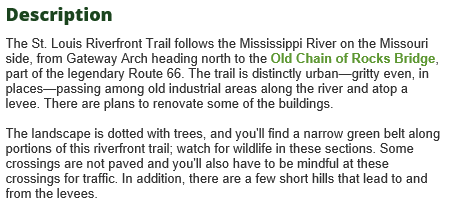
Next morning, we chose to take what we thought was a bit of a risk and head out to the Mississippi River with the intention of riding the St. Louis Riverfront Trail (http://www.traillink.com/trail/st-louis-riverfront-trail.aspx). This is a relatively new trail that starts at the St. Louis Gateway Arch and heads north up river 11 miles to the old Chain of Rocks bridge which is now a bike/pedestrian bridge. It turned out there was a marathon running race that morning starting at the Arch so we thought better to stay away from there as it was likely to be very busy. Instead we headed to the other end having looked at the are on Google maps with aerial imagery we saw there was a parking area right by the chain of rocks bridge so we set the GPS and headed out. It quickly became apparent that the GPS had sent us on the shortest route which took us through some of the roughest parts of north St. Louis. It was a Sunday morning so the streets were quiet and it was bright sunshine. I think at night this would have been a terrifying drive. We drove about 4 miles through the Wells/Goodfellow neighborhood along Goodfellow Blvd. It was shocking and depressingly sad. What must once have a been a thriving community with many big grand brick houses is now a ruin. Many of the buildings were burned out, there was trash everywhere and we saw a sign in one of the few remaining businesses (with barred windows) that said “We Must Stop Killing Each Other”. Talking of businesses, it looked highly likely this was a “food desert” with no sign of a grocery store anywhere. I later read that this area has suffered massive exodus by those that had the wherewithal to get out primarily after the closure of a large GM car plant with cascading consequences for all of the supporting businesses and community at large. Clearly, those left behind are suffering. This article (with many photos of the devastation) describes the situation much better then I can. Many of the houses had great architecture with some super little brick bungalows that would have made really desirable homes in some other hipster neighborhood – but not there.
Things got a little better as we got closer to the river. We passed a large church that had two large arrays of solar panels on the roof. It must have been the community anchor as it looked like the Sunday service was being well attended with many cars parked along the street. We got down onto the river road in the bottom land and finally arrived at the parking area to find it had been closed with a sign directing traffic to another lot that we’d passed about a mile back down the road. So we turned around noting all the trash and tagging graffiti on the concrete barriers closing off the lot.
Heading back down the road I noticed a beat up Ford Taurus coming up quickly behind us. He was soon tailgating. As we approached the left turn for the lot there was a turn lane in the center, Barbara gave a signal and started to move over. There was another car coming the opposite direction on this flat, straight bottom land road. To our combined horror the approaching car drifted quickly into the turn lane heading directly at us with a closing speed of I’d guess somewhere over 80 miles per hour. Barbara swerved to avoiding the oncoming car and with screech of tires the tailgaters behind us almost went in the ditch. I think the oncoming driver was probably texting. We pulled shaken into the lot which was huge with only a handful of other vehicles. We had seen maybe a two or three other trail users. Having been unnerved by the urban blight and the close shave on the highway we thought the better of making ourselves a potential target with the obvious sign of the bike rack on the back of the car and so we hightailed it out of there. Maybe we were a bit wimpy, I don’t know. It seemed a shame to give it up as it looks like some attempt is being made at regeneration with effort to bring people and money in with the trail and all.

We sought a good alternative and chose to go the Creve Coeur Country park by Maryland Heights. We’d been there before several times but not on bikes but for lads’ football (soccer) games and had noticed the bike trails. The wind was blowing very strongly out of the south so we headed out into it so that we’d have a tail wind on the way back. We went all around the lakes but that wasn’t really far enough for a good workout so added on about 8 more miles with a side trip up to the KATY trail where it goes under the highway 364 bridge.

We stopped on the bridge to view the impressive drop to the river below and to check out the lovers padlocks, an imported idea from the Pont des Arts bridge in Paris. The number of locks is small and so is along way from fully emulating the French version but we wondered how long it will be before they build up enough for the authorities to take the same action as in Paris where the excessive weight of many thousands of locks was potentially damaging and they had to be removed. We paid for an easy wind assisted cruise out with a 4 mile flog back into teeth of the wind. My phone battery gave out so my Cycle Tracks GPS bike tracker didn’t record the whole trip but I later figured on Google maps that we’d done about 20 miles. The day worked out well in the end after such a sketchy start.
